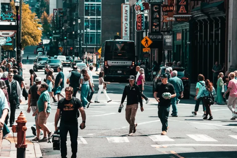

Creating truly walkable neighborhoods requires more than just sidewalks; it demands a strategic integration of urban planning principles that prioritize human movement, local commerce, and community interaction. For city planners, developers, and community advocates, the challenge lies in identifying and implementing ideas that deliver measurable improvements in pedestrian activity, safety, and quality of life. This guide outlines key urban planning ideas, detailing their practical applications, benefits, and potential drawbacks, to inform decisions aimed at fostering vibrant, pedestrian-friendly environments.
What to Look For in Walkable Neighborhood Planning
When evaluating urban planning ideas for walkability, focus on several core characteristics. First, look for strategies that promote density and mixed uses, ensuring that daily necessities and amenities are within a short walking distance. Proximity reduces reliance on vehicles and encourages foot traffic. Second, prioritize designs that enhance safety and comfort for pedestrians, including adequate lighting, clear sightlines, and separation from vehicular traffic where necessary. Third, consider how well an idea integrates with existing infrastructure and community needs, ensuring it is context-sensitive and adaptable. Fourth, assess the potential for placemaking—creating distinct, attractive public spaces that invite people to linger and interact. Finally, evaluate the long-term sustainability and economic viability of each approach, as walkable neighborhoods often drive local economic growth and reduce infrastructure costs associated with car-centric development.
1. Mixed-Use Zoning Ordinances
Mixed-use zoning permits a combination of residential, commercial, cultural, institutional, or industrial uses within a single building or a specific area. This departure from traditional single-use zoning aims to create environments where people can live, work, shop, and recreate without extensive travel. By integrating diverse functions, mixed-use developments reduce commute times, foster local economies, and increase the vibrancy of public spaces throughout the day and evening.
Best for: Revitalizing urban cores, developing new transit-oriented communities, and enhancing neighborhood self-sufficiency.
Pros: Reduces vehicle miles traveled, supports local businesses by increasing foot traffic, creates active streetscapes, and offers diverse housing options. It also optimizes land use, making neighborhoods more resilient and less reliant on external services.
Cons: Can lead to conflicts between different uses (e.g., noise from commercial establishments near residences), requires careful planning to manage traffic and parking demands, and may face initial resistance from residents accustomed to single-use zones.
Verdict: Essential for creating dynamic, self-sustaining walkable neighborhoods, but demands meticulous planning and community engagement to mitigate potential conflicts and ensure harmonious integration of uses.
2. Complete Streets Design Principles
Complete Streets is an approach to street design that ensures roadways are safe and accessible for all users, regardless of age, ability, or mode of transportation. This involves incorporating features like wide sidewalks, dedicated bike lanes, transit stops, accessible pedestrian signals, and safe crossing opportunities. The goal is to create a balanced transportation network where pedestrians, cyclists, transit riders, and motorists can coexist safely and efficiently.
Best for: Upgrading existing street infrastructure, creating equitable transportation access, and connecting different parts of a community.
Pros: Enhances safety for pedestrians and cyclists, encourages active transportation, improves public health, increases property values, and provides more equitable access to services and amenities for all community members.
Cons: Implementation can be costly, may require reallocation of road space (potentially reducing vehicle lanes or parking), and can face opposition from motorists concerned about traffic flow or parking availability.
Verdict: A foundational strategy for any walkable neighborhood initiative, directly impacting safety and promoting active travel modes, though requiring significant investment and political will.
3. High-Density, Human-Scale Development
This idea focuses on developing areas with a higher concentration of buildings and residents, but importantly, ensuring that the scale and design of these developments remain human-friendly. It involves building upwards rather than outwards, often with smaller setbacks, varied building facades, and ground-floor retail. The emphasis is on creating a compact urban form that supports walkability by placing more people and services within a smaller geographic area, without overwhelming the pedestrian experience.
Best for: Optimizing land use in urban and suburban areas, supporting public transit, and fostering a critical mass for local businesses.
Pros: Reduces urban sprawl, supports public transit viability, increases housing affordability (through diverse housing types), and creates a vibrant street life. It also minimizes infrastructure costs per capita and preserves open space.
Cons: Can lead to concerns about overcrowding, loss of privacy, increased traffic congestion if not paired with robust transit, and may face "not in my backyard" (NIMBY) resistance from existing residents.
Verdict: Crucial for establishing the necessary population base to support walkable amenities, but its success hinges on thoughtful design that prioritizes pedestrian comfort and aesthetic integration.
4. Enhanced Pedestrian Infrastructure
Beyond basic sidewalks, enhanced pedestrian infrastructure includes features like wider sidewalks, high-quality paving materials, ample street lighting, comfortable street furniture (benches, waste receptacles), public art, and effective stormwater management. It also encompasses well-marked, safe crosswalks, pedestrian refuge islands, and accessible ramps. The goal is to make walking not just possible, but pleasant, safe, and inviting, encouraging people to choose walking over driving for short trips.
Best for: Improving the comfort, safety, and aesthetic appeal of existing walkable areas and making new developments genuinely pedestrian-friendly.
Pros: Directly increases walking rates, improves pedestrian safety, enhances public realm aesthetics, supports local commerce by encouraging lingering, and contributes to a stronger sense of place and community identity.
Cons: Significant upfront costs for construction and ongoing maintenance, potential disruption during construction, and requires consistent enforcement of pedestrian-friendly policies (e.g., clear sidewalks).
Verdict: A direct and highly effective investment in walkability, yielding immediate benefits in safety and user experience, which are fundamental to encouraging pedestrian activity.
5. Integrated Public Transit Networks
Integrating public transit effectively means designing routes and stops to be easily accessible by foot, connecting them seamlessly with walkable destinations, and ensuring frequent, reliable service. This includes prioritizing transit within Complete Streets designs, developing transit-oriented developments (TODs) around key stops, and providing clear wayfinding to and from transit hubs. A robust transit system reduces the perceived necessity of car ownership, reinforcing the walkability of a neighborhood.
Best for: Reducing car dependency, connecting neighborhoods to broader urban areas, and supporting higher-density development.
Pros: Decreases traffic congestion and pollution, expands access to jobs and services for non-drivers, reduces household transportation costs, and fosters economic development around transit hubs. It also promotes social equity.
Cons: High capital and operational costs, requires significant political and public support, and can be challenging to implement in low-density or sprawling areas. Service frequency and reliability are critical for adoption.
Verdict: Indispensable for extending the reach and utility of walkable neighborhoods beyond immediate blocks, transforming local walkability into regional accessibility and reducing car dependence.
6. Accessible Green Spaces and Parks
Incorporating and connecting green spaces, parks, and natural areas within walking distance of residences and businesses provides essential recreational opportunities, improves air quality, and enhances mental well-being. Accessibility means not only proximity but also safe, well-maintained pedestrian paths leading to and through these spaces. Linear parks, greenways, and pocket parks contribute significantly to the pedestrian experience, offering respite and opportunities for physical activity.
Best for: Enhancing quality of life, providing recreational opportunities, and improving environmental health within urban settings.
Pros: Improves public health, provides ecosystem services (e.g., stormwater management, urban cooling), increases property values, fosters community interaction, and offers aesthetic appeal. It also creates safe routes for walking and cycling.
Cons: Requires significant land acquisition or dedication, ongoing maintenance costs, and can be challenging to integrate into already dense urban fabric. Equity in access across different neighborhoods is also a concern.
Verdict: Vital for creating livable, attractive walkable neighborhoods by offering essential amenities for recreation and relaxation, significantly influencing residents' willingness to walk.
7. Traffic Calming and Speed Management
Traffic calming involves implementing physical design elements and strategies to reduce vehicle speeds and improve safety for pedestrians and cyclists. This includes speed humps, raised crosswalks, chicanes, narrower travel lanes, and roundabouts. The goal is to make streets feel less like high-speed thoroughfares and more like shared public spaces, increasing pedestrian comfort and safety, especially in residential and commercial areas.
Best for: Improving safety in residential areas, near schools, and in commercial districts where pedestrian activity is high.
Pros: Significantly reduces vehicle speeds and collisions, improves pedestrian and cyclist safety and comfort, reduces noise pollution, and enhances the overall quality of the street environment for non-motorized users.
Cons: Can increase emergency response times if poorly designed, may cause inconvenience for drivers, and requires careful design to avoid unintended consequences like diverting traffic to other residential streets.
Verdict: A highly effective tactical intervention for making existing streets more pedestrian-friendly by directly addressing the perceived danger and discomfort posed by fast-moving traffic.
8. Local Business Support and Placemaking
Fostering a vibrant ecosystem of local businesses and engaging in placemaking initiatives helps create destinations that draw people on foot. Placemaking involves designing public spaces to promote well-being and interaction, often through public art, flexible seating, outdoor cafes, and pop-up markets. Supporting local businesses through zoning, incentives, and marketing ensures there are diverse, unique reasons for people to walk to and engage with their neighborhood commercial centers.
Best for: Creating vibrant commercial corridors, fostering community identity, and providing economic anchors for walkable areas.
Pros: Increases foot traffic, supports local economy and job creation, enhances community pride and identity, provides unique cultural experiences, and creates lively, attractive public spaces that encourage social interaction.
Cons: Can be challenging to compete with large retail chains, requires ongoing management and programming for public spaces, and may lead to gentrification concerns if not managed equitably.
Verdict: Beyond infrastructure, this strategy creates the "why" for walking, transforming functional pathways into desirable destinations and fostering a strong sense of community.
9. Connected Bicycle Infrastructure
While distinct from pedestrian infrastructure, well-designed and connected bicycle networks significantly enhance the overall walkability and active transportation ecosystem. This includes protected bike lanes, shared-use paths, secure bike parking, and clear signage. When integrated with pedestrian routes and public transit, bicycle infrastructure extends the effective range of non-motorized travel, allowing people to reach destinations slightly too far to walk comfortably, without resorting to a car.
Best for: Expanding active transportation options, reducing short-distance car trips, and connecting neighborhoods to a wider range of destinations.
Pros: Improves public health, reduces traffic congestion and emissions, offers an efficient mode of transport for intermediate distances, and enhances recreational opportunities. It also complements pedestrian networks.
Cons: Requires dedicated space, which can be challenging in dense areas; safety concerns if not properly separated from vehicle traffic; and initial costs for construction and maintenance can be substantial.
Verdict: A complementary strategy that, when thoughtfully integrated, significantly boosts a neighborhood's overall active mobility score, making it easier for residents to live car-free or car-light lifestyles.
10. Form-Based Codes Implementation
Form-based codes are a type of zoning regulation that focuses on the physical form of buildings and public spaces, rather than just land use. They establish clear guidelines for building height, setbacks, facade articulation, and street-level design, all with the aim of creating a cohesive, pedestrian-friendly urban environment. These codes prioritize the public realm and ensure that new development contributes positively to the streetscape, making it more inviting for walkers.
Best for: Guiding new development and redevelopment in urban centers or specific corridors to ensure a consistent, pedestrian-oriented character.
Pros: Creates predictable urban forms conducive to walking, promotes architectural compatibility, encourages mixed-use development, and streamlines the development review process by providing clear design expectations.
Cons: Can be complex to develop and implement, may limit design flexibility for architects, and can be perceived as overly prescriptive by some developers. Requires public understanding and buy-in.
Verdict: A powerful regulatory tool for shaping the physical environment to inherently support walkability, ensuring that new construction aligns with a pedestrian-first vision.
11. Adaptive Reuse and Historic Preservation
Adaptive reuse involves repurposing existing buildings for new functions, while historic preservation focuses on maintaining the character and integrity of historically significant structures. Both strategies contribute to walkable neighborhoods by retaining existing urban fabric, preserving unique architectural character, and preventing the demolition of buildings that often provide human-scale interest and contribute to a sense of place. This approach avoids the creation of blank, car-oriented spaces that often result from new construction on cleared sites.
Best for: Maintaining neighborhood character, promoting sustainable development, and creating unique, authentic destinations that attract pedestrians.
Pros: Reduces construction waste and energy consumption, preserves cultural heritage, creates unique commercial and residential spaces, and often results in more fine-grained, pedestrian-friendly streetscapes than new builds.
Cons: Can be more expensive and complex than new construction due to structural challenges or regulatory hurdles, and may require specialized expertise. Existing buildings may not always meet modern accessibility or energy efficiency standards without significant modification.
Verdict: A sustainable and character-rich approach that leverages existing assets to create engaging, human-scale environments that inherently encourage walking and exploration.
12. Comprehensive Wayfinding Systems
A comprehensive wayfinding system uses clear and consistent signage, maps, and digital tools to help pedestrians navigate an area, find destinations, and understand walking distances and times. This includes physical signs at key intersections, information kiosks in public spaces, and integration with mobile applications. Effective wayfinding reduces anxiety for unfamiliar visitors and encourages exploration, making a neighborhood feel more accessible and walkable.
Best for: Enhancing visitor experience, connecting disparate attractions, and encouraging longer walking trips by providing clarity and confidence.
Pros: Improves pedestrian confidence and comfort, encourages exploration of local businesses and attractions, facilitates connections to public transit, and enhances the overall visitor experience. It also promotes a sense of place.
Cons: Requires careful design and strategic placement to avoid visual clutter, ongoing maintenance, and can be costly to implement across a large area. Consistency in branding and information is critical.
Verdict: A crucial, often overlooked, element that transforms a collection of walkable streets into a cohesive, easily navigable pedestrian network, maximizing the utility of other walkability investments.
Measuring the Success of Walkability Initiatives
To determine the effectiveness of implemented urban planning ideas, quantitative and qualitative metrics are essential. Quantitative measures include pedestrian counts (e.g., using sensors or manual surveys), vehicle miles traveled (VMT) reduction, public transit ridership, and changes in local business revenue. Safety data, such as pedestrian-involved collision rates, also provides critical insights. Qualitatively, gather feedback through community surveys, public forums, and observational studies to assess perceived safety, comfort, and satisfaction. Document changes in property values, housing diversity, and the number of active community groups as indicators of a thriving, walkable environment. Regular monitoring and evaluation allow for iterative adjustments and demonstrate accountability to stakeholders.
Frequently Asked Questions
What is the most important factor for a walkable neighborhood?
Proximity to diverse amenities and destinations is often considered the most critical factor. If people can meet their daily needs—shopping, work, recreation—within a short walk, they are far more likely to choose to walk.
How can existing car-centric neighborhoods become more walkable?
Strategies include implementing Complete Streets designs, introducing mixed-use zoning, enhancing pedestrian infrastructure, and adding traffic calming measures. Incremental changes, such as adding crosswalks or improving sidewalks, can build momentum.
What role does technology play in walkable neighborhoods?
Technology can enhance walkability through smart traffic signals that prioritize pedestrians, real-time public transit information, digital wayfinding apps, and sensors for monitoring pedestrian activity and air quality. These tools support planning and improve user experience.
Is gentrification a concern with walkable neighborhood development?
Yes, improved walkability often increases property values, which can lead to displacement of long-term residents and businesses. Planning must include equitable housing policies, affordable commercial spaces, and community land trusts to mitigate these risks and ensure benefits are shared.
How can communities fund walkability projects?
Funding sources include federal grants (e.g., for transportation or environmental initiatives), state and local bonds, public-private partnerships, dedicated sales taxes, and impact fees on new developments. Community improvement districts can also provide funding through special assessments.